In an increasingly interconnected world, instilling a love and understanding of geography, history, and cartography in our children is more important than ever. Maps and map art provide visually captivating and educational tools to engage children in the fascinating world of cartography and expose them to diverse landscapes, cultures, and histories globally. The Maps of Iceland offers an extensive range of kid-friendly map prints and framed posters that cater to various age groups, interests, and skill levels, making it the perfect resource for parents and educators looking to inspire a love of learning and discovery in their children.
This blog will explore the educational benefits of incorporating maps and map art into children’s learning experiences, emphasizing the importance of building geographical knowledge and fostering an appreciation for diverse cultures and histories. We will showcase the Maps of Iceland’s collection of educational maps tailored to children and provide valuable tips on selecting age-appropriate and engaging maps to meet your needs.
Additionally, we will offer creative ideas for integrating maps and map art into children’s learning spaces, whether in the classroom or at home. Unleash the potential of cartography as an educational tool and ignite your child’s curiosity and love of learning with the enchanting collection available at the Maps of Iceland.
Educational Benefits: Engaging Young Minds with Maps and Map Art
Exploring the impact and advantages of maps and map art in teaching geography, history, and cartography to children.
1. Geography: Building Spatial Awareness
Maps play a vital role in developing children’s spatial awareness and understanding of the world, teaching them about various landscapes, countries, and the unique characteristics of each region.
2. History: Connecting to the Past
Historical maps offer an engaging visual representation of past events and changes in our world. They provide insights into political shifts, social transformations, and how societies have evolved over time.
3. Cartography: Appreciating the Art of Mapmaking
By introducing children to different types of maps and artistic styles, you can foster an appreciation for cartography and inspire them to explore the creative aspects of mapmaking.
Maps of Iceland Collection: A World of Learning Opportunities
Discover the enriching and age-appropriate maps available at the Maps of Iceland, tailored to captivate and educate young minds.
1. Educational Wall Maps
Choose from a range of educational wall maps that teach children about geography and history while making an attractive addition to their learning space.
2. Interactive Maps
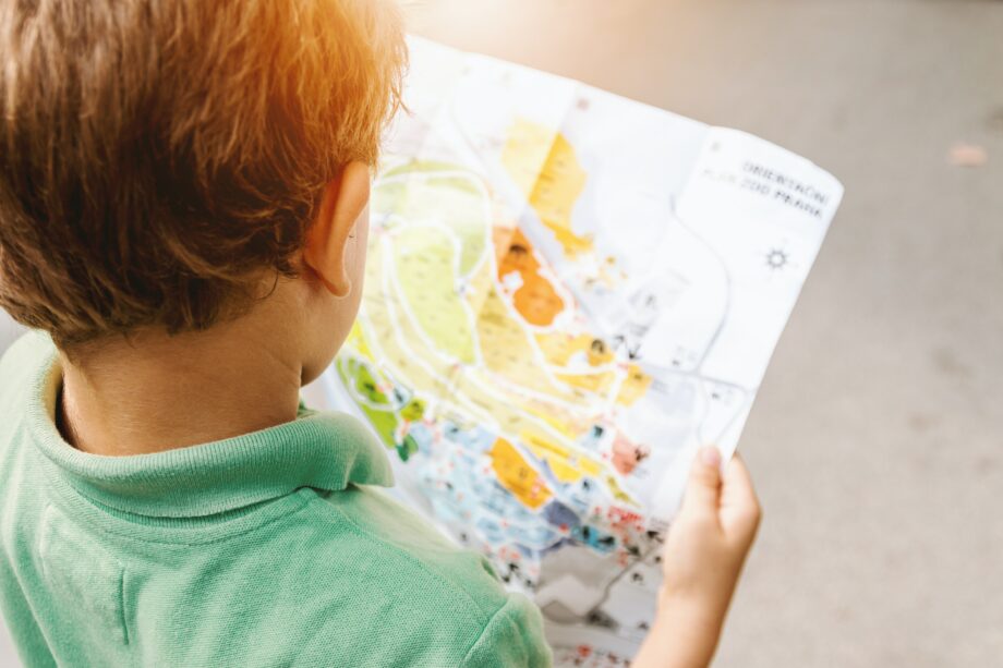
Engage young learners with interactive maps that allow them to manipulate, explore, and discover unique features and elements of the world on their own terms.
3. Specialty Maps
From topographic maps to illustrated cityscapes, specialty maps can enhance a child’s understanding of geography and inspire their curiosity about diverse places and cultures.
Selecting the Right Maps for Your Child’s Age and Interests
Ensure learning success with age-appropriate and engaging maps that cater to your child’s specific needs and interests.
1. Age-Appropriate Content
Select maps that cater to your child’s age group, considering factors such as the complexity of the map’s information and the level of visual detail.
2. Connecting to Personal Interests
Choose map prints or posters that incorporate your child’s interests, whether that involves specific countries, historical settings, or unique visual styles.
3. Maps for Skill Building
Utilize maps that teach fundamental skills such as map reading, measurement, and spatial awareness to help your child develop a strong foundation for future learning and geographical understanding.
Creative Ways to Integrate Maps and Map Art into Children’s Learning Spaces
Inspire learning and curiosity with innovative techniques for incorporating maps and map art into your child’s educational environment.
1. Design a Geographic Gallery Wall
Curate a visually captivating gallery wall in your child’s room or play area, showcasing a collection of map prints, framed posters, and educational wall maps to spark inquiry and learning.
2. DIY Map-Based Activities
Create engaging, hands-on activities using maps, such as treasure hunts, geography quizzes, or collaborative map-building projects to combine learning with play.
3. Repurposing Maps as Educational Art
Transform outdated or damaged maps into unique art pieces that retain their educational value and visually enchant your child while promoting learning.
Conclusion
Integrating maps and map art into your child’s educational journey is an invaluable way to foster a love of geography, history, and cartography from a young age. The Maps of Iceland offers a diverse collection of kid-friendly map prints and framed posters designed to pique curiosity and kindle a passion for learning.
By selecting age-appropriate maps that cater to your child’s interests and using creative techniques to integrate them into their learning space, you provide an engaging, enriching, and captivating educational experience that will lay a strong foundation for their academic success.
Begin your child’s learning adventure with the Maps of Iceland’s educational map collection. Explore our wide range of map posters tailored to children, and find the perfect tools to unlock your child’s creativity and wonder for the world around them. Ignite their passion for geography, history, and cartography today.