-18x18-person-61f12290dd769")
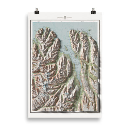
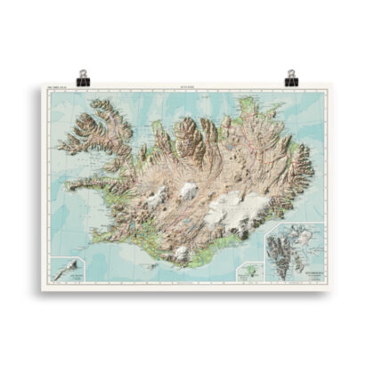
Öræfajökull Volcano Map
Print size: 18×18 inches (46×46 cm)
This map is a part of the Volcano Map Series from Maps of Iceland. The original maps used as textures were surveyed between 1905 and 1930.
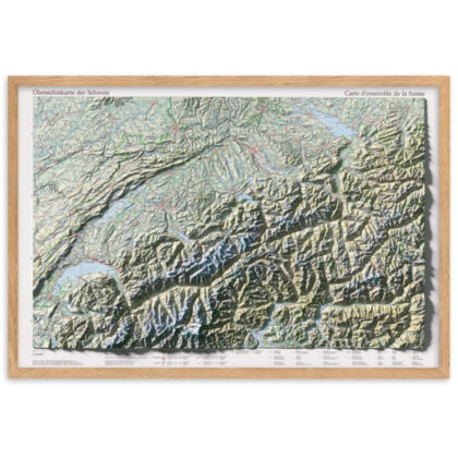
For decades, the so-called Atlas maps were at the scale of 1: 100,000 the main topographic maps of Iceland. Even today, there are many who take those cards over the other end with well-made variations and beautiful cards. The origins of the Atlas maps can be found in the very ambitious Danish map-making in Iceland
Antique map, combined with Digital Elevation Data to produce shaded relief to create the illusion of 3D. The shading is printed on the paper and not a result of the map protruding from the surface.
Please Note: Text and place names on this Iceland Shaded Relief Map can be difficult to read due to font size, shaded relief covering some of the text, and the age of the original map – we suggest the larger size map if you would like better legibility.
Follow us on Instagram and Facebook to see our latest maps and works in progress
See more of our various types of Iceland maps here
• Paper thickness: 10.3 mil
• Paper weight: 5.57 oz/y² (189 g/m²)
• Giclée printing quality
• Opacity: 94%
• ISO brightness: 104%
Reviews
There are no reviews yet.