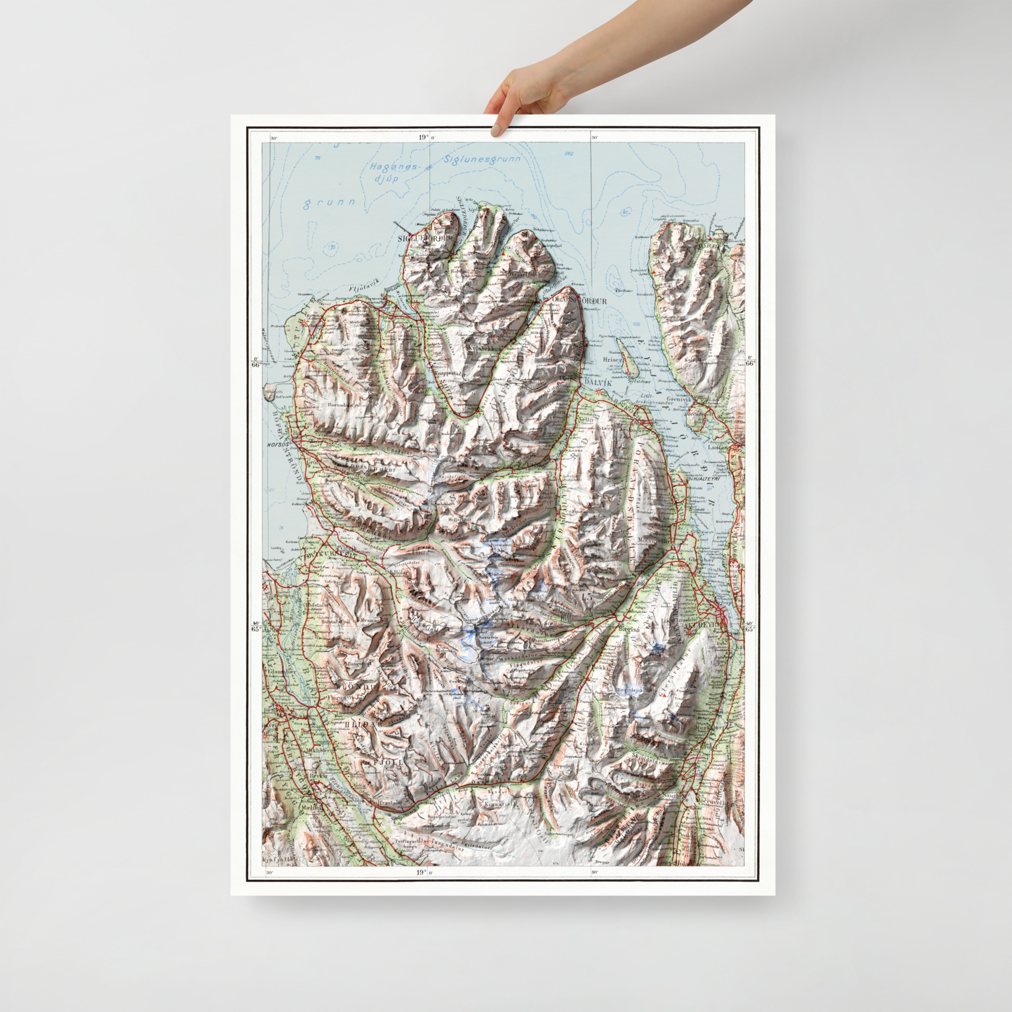
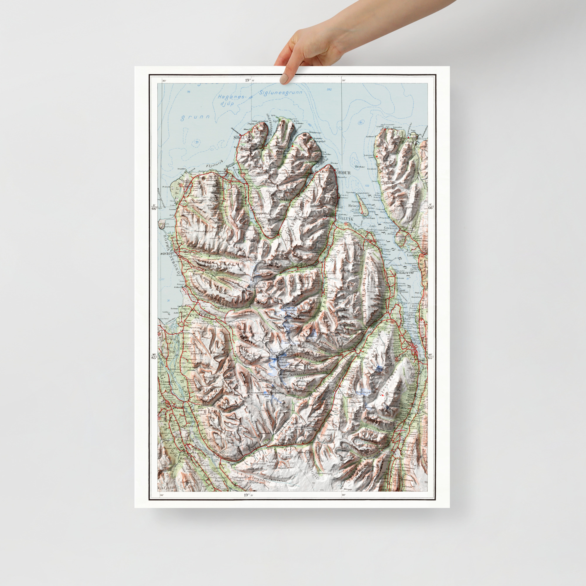
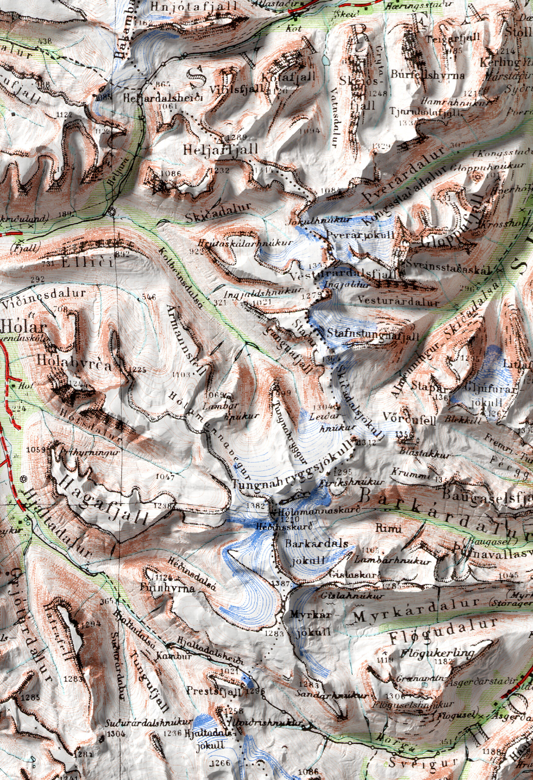
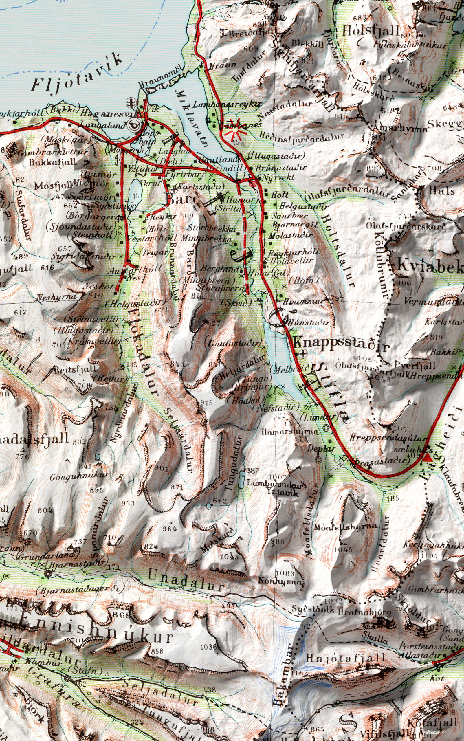
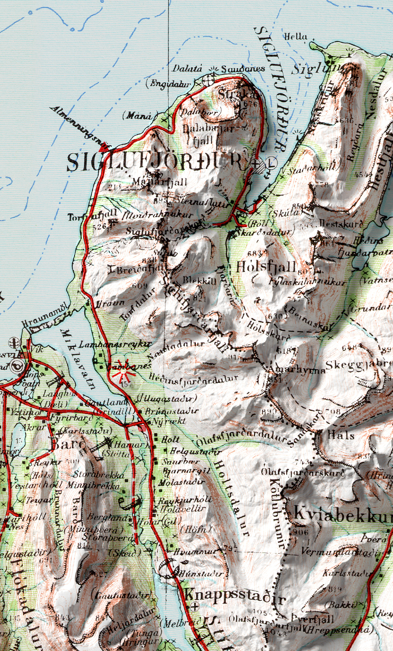
Antique map of Tröllaskagi (Trolls Peninsula), combined with Digital Elevation Data to produce shaded relief to create the illusion of 3D. The shading is printed on the paper and not a result of the map protruding from the surface.
Available in 2 different sizes:
70×100 cm
50×70 cm
Tröllaskagi is a peninsula in northern Iceland on the, between the fjords of Eyjafjörður and Skagafjörður. The peninsula is mountainous, with several peaks reaching over 1,000 meters above sea level. Tröllaskagi is the part of Iceland with the highest elevation outside the central highlands. The peninsula is cut by several deep valleys that were carved by glaciers during the glacial periods of the last Ice age and later by the rivers that now flow down those valleys. A few permanent glacial ice caps still exist in central Tröllaskagi, but they are all rather small.
• Paper thickness: 0.26 mm (10.3 mil)
• Paper weight: 189 g/m²
• Opacity: 94%
• ISO brightness: 104%
• 21 × 30 cm posters are size A4
• Paper sourced from Japan
This product is made especially for you as soon as you place an order, which is why it takes us a bit longer to deliver it to you. Making products on demand instead of in bulk helps reduce overproduction, so thank you for making thoughtful purchasing decisions!

Reviews
There are no reviews yet.